The Dick Bail Memorial Bike Route

Annual Boston to Provincetown bike rides, 1983-2025

50 years ago, New England was experiencing a heat wave similar to the present. In July 1975, the temperatures in Boston were often over 100. As a college junior of limited means who decided to stay in the (non-air conditioned) dorms over the summer, I was desperate to escape to Cape Cod over the weekend. I had no car, no friends to drive me, the buses were fully booked, and there was no place to stay there anyway.

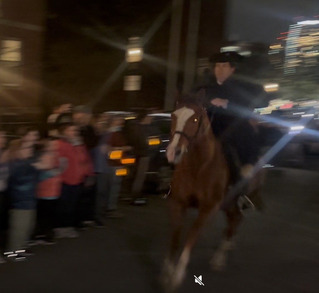
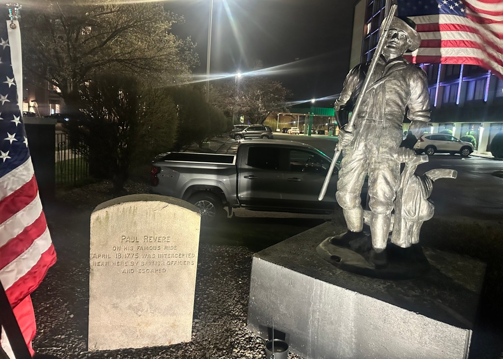
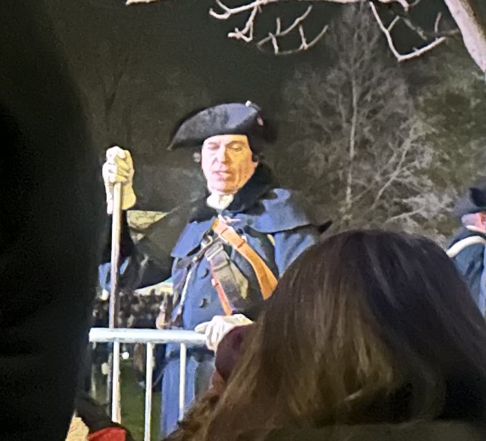
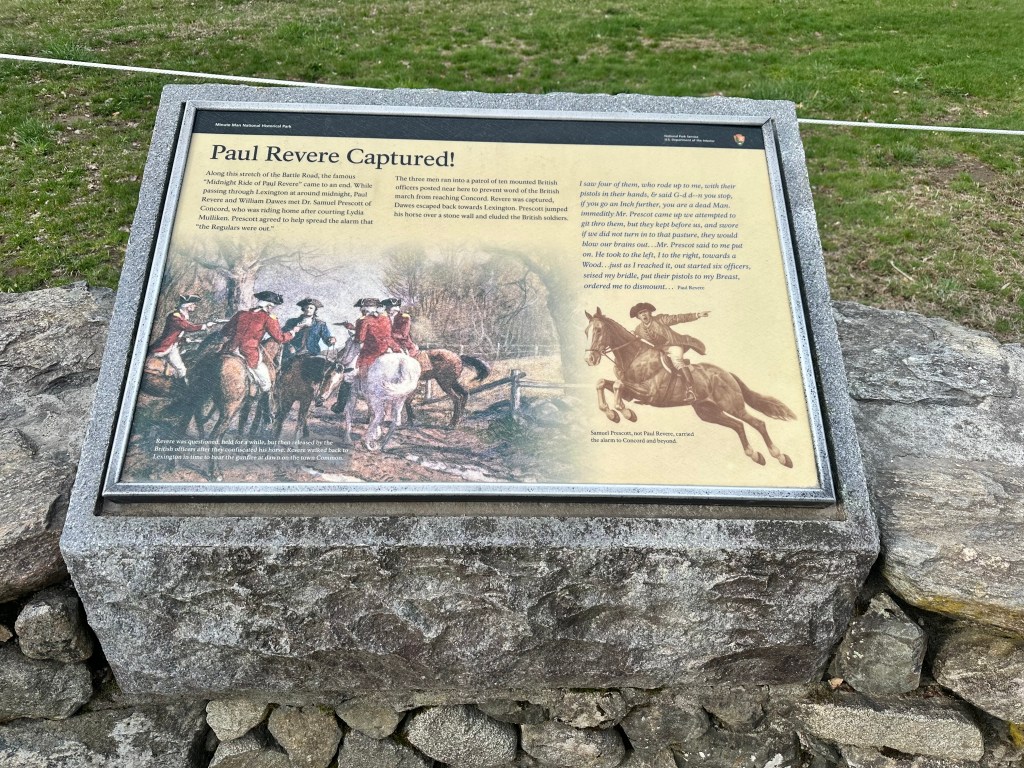
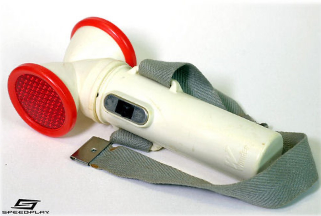
Perhaps long on academics but short on common sense, I decided to ride my bike. Surely I’d find someplace to camp once I got there. It was way too hot to bike in the daytime, but just three months earlier I’d taken that all night ride following Paul Revere, why couldn’t I do it again? Still on a cheap 10-speed, still with no helmet, but at least I had a light of sorts. Do any of you remember Wonder Lights, those gizmos you strapped to your left knee? The anemic flashlight bulb within would bob up and down as you pedaled, hopefully attracting the attention of drivers.

You’ve got to be kidding me

How to get through the sketchy neighborhoods south of Boston? Simple: just sneak your bike onto the Red Line (illegal back then) and hope nobody caught you before you got to Braintree.

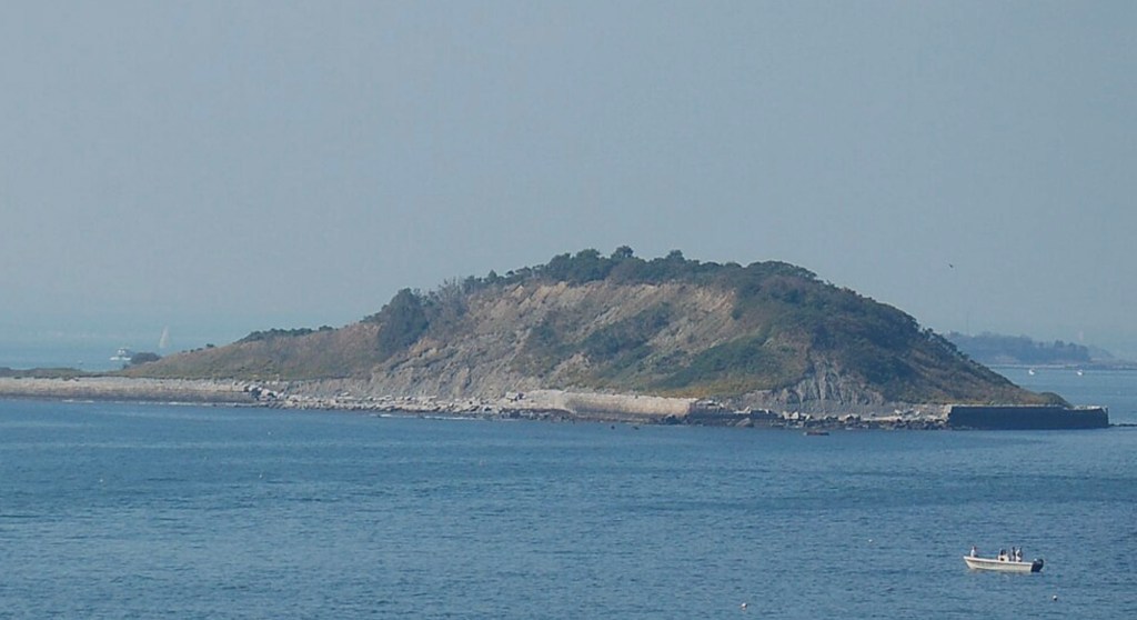
Improbably, it all went off without a hitch. Nobody caught me, and by 11 PM I was cycling down busy Route 3A from Braintree through the South Shore towns of Cohasset, Scituate, Marshfield, and Plymouth. No close calls, the traffic thinned out after 1AM, the sidewalk on the Sagamore Bridge wasn’t too bad, and cruising Route 6A on the Upper Cape in the wee hours was oddly peaceful. I only wished for a place to get a snack and a coffee.

The sun was just rising as I hit Coast Guard Beach in Eastham, and I collapsed gratefully on the sand. I wasn’t dozing for 10 minutes before I was nudged awake by a park ranger.

“You can’t sleep here.”

“ I can’t take a snooze on the beach?”

“You obviously biked a long way with your camping gear, and there’s no camping on the beach. You have to find a campground.”

I called every campground in the Yellow Pages, all were full. The ranger had no suggestions, and kept his eye on me. I saw I had no choice but to return to Boston.

As a college kid, I’d pulled my share of all-nighters, but never like this. I didn’t think you could fall asleep while riding a bicycle, but a couple of times I nodded off on 6A, the wobbling bike snapped me back awake. I tried to lay down in the grass next to the road, but invariably a concerned motorist would stop and ask if I was OK. I was now desperate for coffee, but the only establishments on 6A were real estate offices and antique stores. I somehow made it back to Plymouth at 11 PM, where a Good Samaritan saw me staring dolefully at my map, wondering how to get back through those sketchy neighborhoods after the subways had shut down, and offered to give me a lift to my dorm in his pickup truck. So despite my idiocy, I survived.

Claire Saltonstall wasn’t so lucky. Biking to the Cape by a different route in broad daylight the previous year, the 16-year-old had been killed by a motorist who veered into the breakdown lane. Her grandfather was renowned US Senator Leverett Saltonstall, her father was state senator William, who had advocated for safe bicycle routes for years. The driver was clearly at fault but refused to apologize, on his lawyer’s advice. The high profile trial set the precedent that apologies could no longer be construed as tantamount to an admission of guilt. Anyway, the family funded the creation of a safe route to Cape Cod called the Claire Saltonstall Bikeway. https://en.wikipedia.org/wiki/Claire_Saltonstall_Bikeway

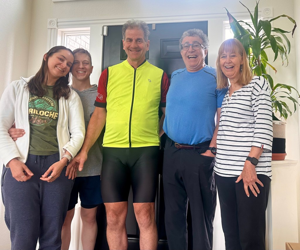
Fast forward to 1983. Older and wiser, with a medical degree to boot, I no longer considered biking without a helmet. I had a fancy new bicycle. And best of all, I had a biking buddy who was game for anything.

A buddy and a mentor. Richard Nelson Bail was the finest doctor I’ve ever known, and I’ve known some great ones (see my On the Shoulders of Giants post a few blogs back.) In an incredible stroke of luck, he was assigned as my principal precptor in my Primary Care Internal Medicine residency, at the Harvard Community Health Plan. Dick had it all: academic rigor, intellectual curiosity, a bedside manner to put Marcus Welby to shame, and a teacher par excellence. He was a role model to aspire to for the rest of my life, even as he set a target I could never hope to reach.

Dick Bail

A real Renaissance man, his bio is so long it would make this post unwieldy, I encourage you to read this tribute. https://www.communitieswithoutborders.org/the-passing-of-richard-nelson-bail/ Suffice it to say his altruism and community involvement matched his medical skills. To top it off, he was a great athlete, one of those 2% body fat guys. He biked to work year round, and ran during his lunch hour. No fancy bike for him, he had a beat up 1960s Raleigh Grand Prix, a milk crate bolted to an old child seat rack in back plastered with a bumper sticker for Moosehead Beer: The Moose is Loose! It didn’t matter—12 years younger, I couldn’t keep up with him.

That summer we hit upon the idea of trying to bike from Boston to the tip of Cape Cod in a single day. We would do it in June when the days are the longest, leave at the crack of dawn and hopefully get in before it got dark. The Saltonstall Bikeway was over 130 miles and Dick, who had grown up in southeastern Massachusetts, suggested enhancements (many involving beaches, scenic bike paths and detours to places like Plymouth Rock and Wellfleet Harbor, favorite swimming holes, and ice cream stands) which made the total closer to 150.

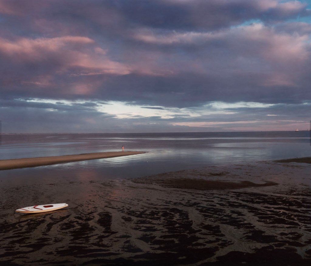
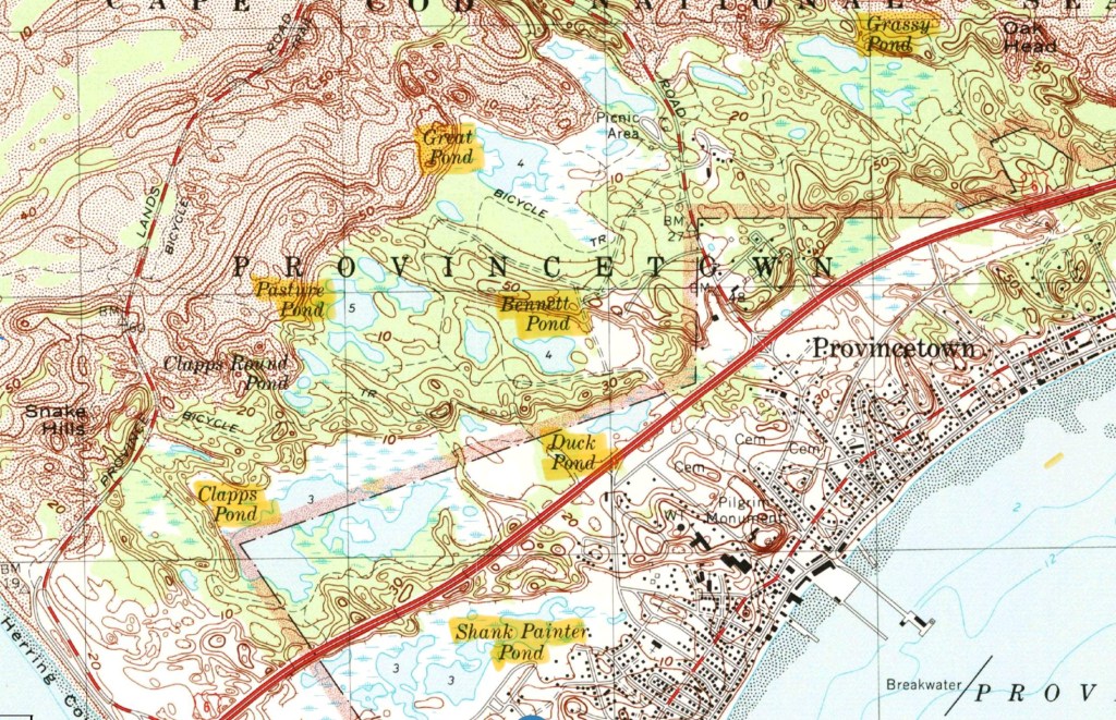
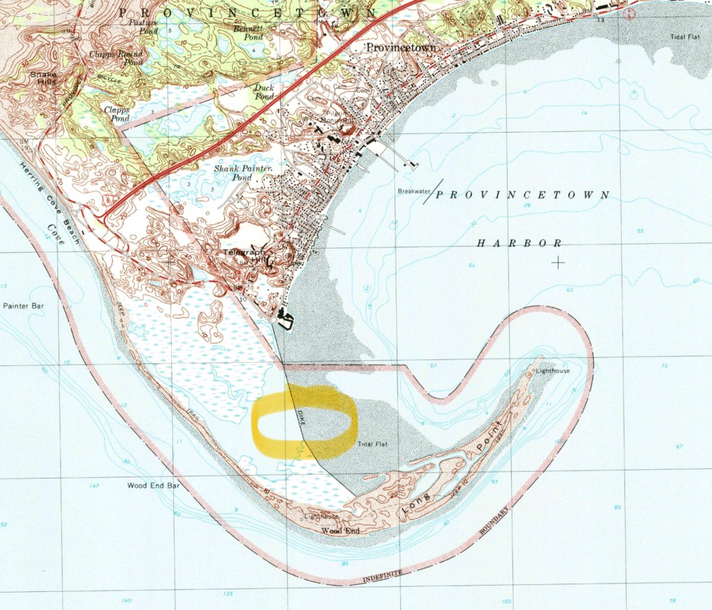
Once again, it went off without a hitch. Well OK, I was a little numb in the crotch for a couple of hours but overall, we were delighted. After spending the night in Provincetown, we took the ferry back to Boston, passing right over Stellwagen Bank, where all the whale watch ships go. Entering the city by sea is a moving experience.

We thought it would just be a one-off, a stunt, but the following year we realized we’d liked it so much we tried it again, and brought some other friends along. It turned into an annual tradition in spite of ourselves, and with further embellishments and refinements we dubbed it Beantown to Ptown with Claire. Sometimes, as many as 15 people would join us.

Other groups had similar ideas, organizing supported group rides, fundraisers for multiple sclerosis and AIDS research, and most notably the Pan Mass Challenge to support the Dana Farber Cancer Institute. An LGBTQ group, the Outriders, marks their route with distinctive green arrows on the pavement http://www.outriders.org/index.html.

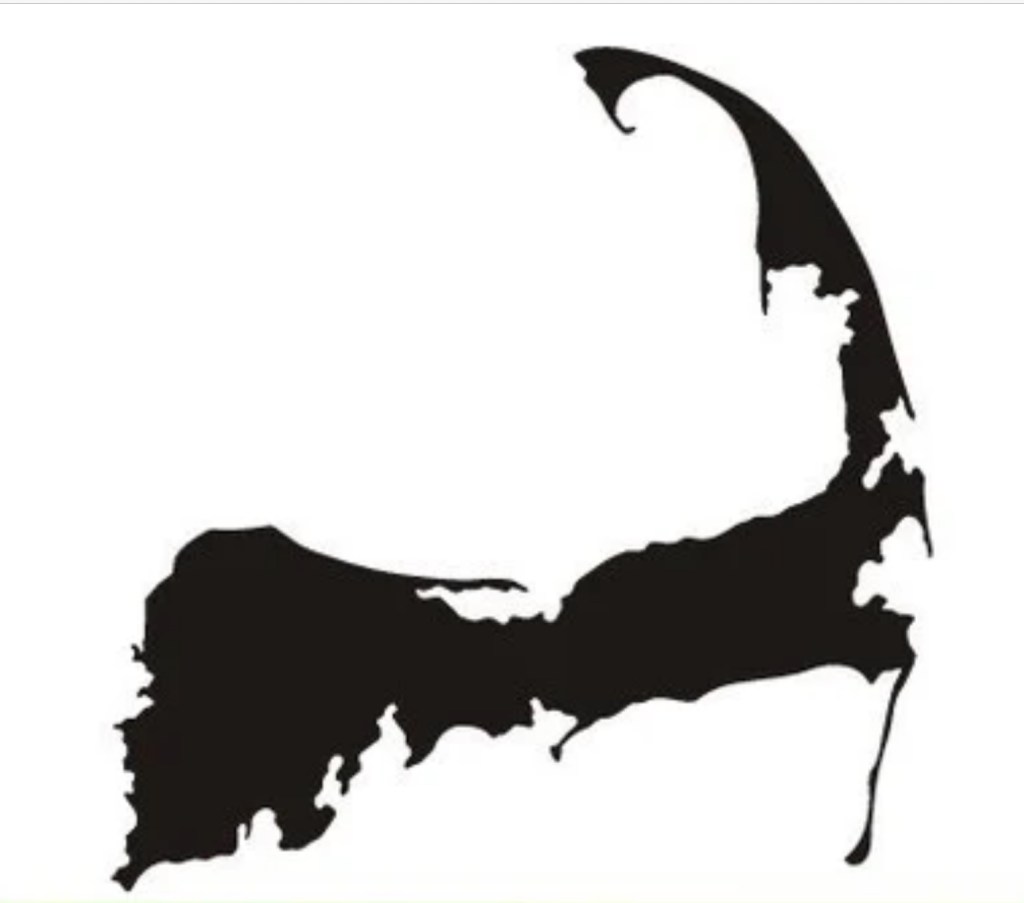
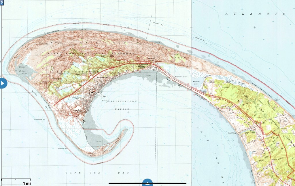
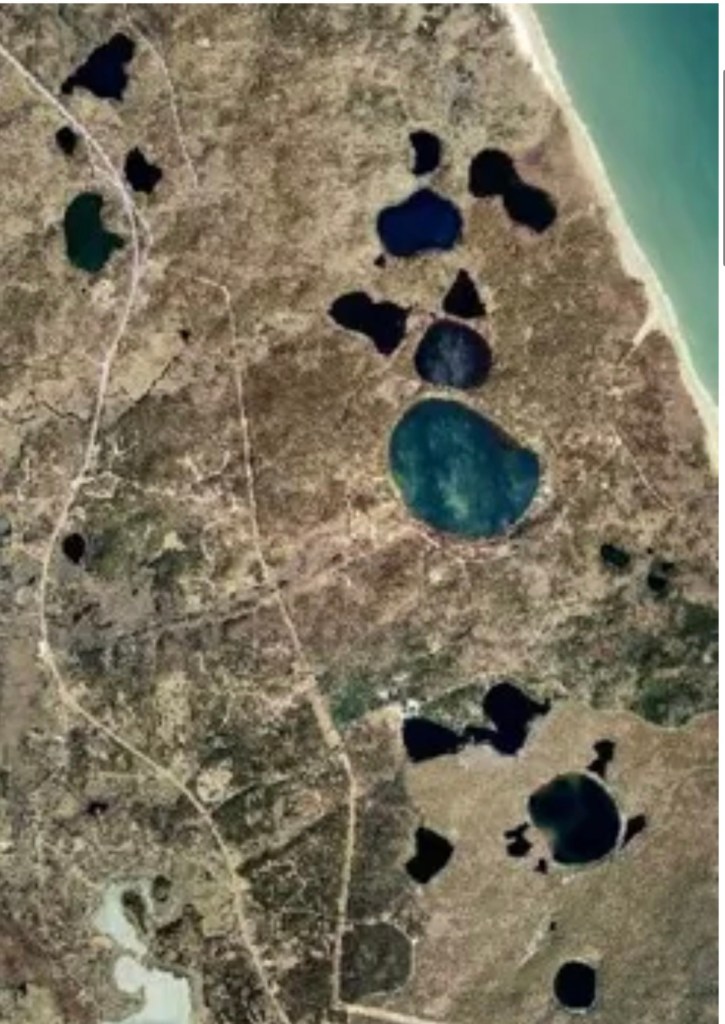
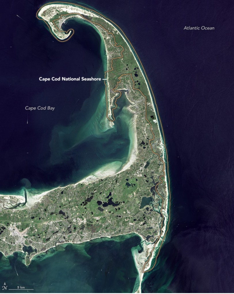
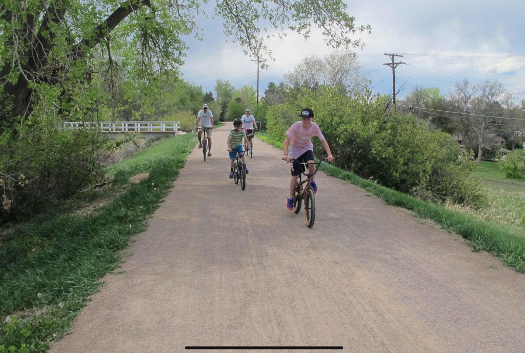
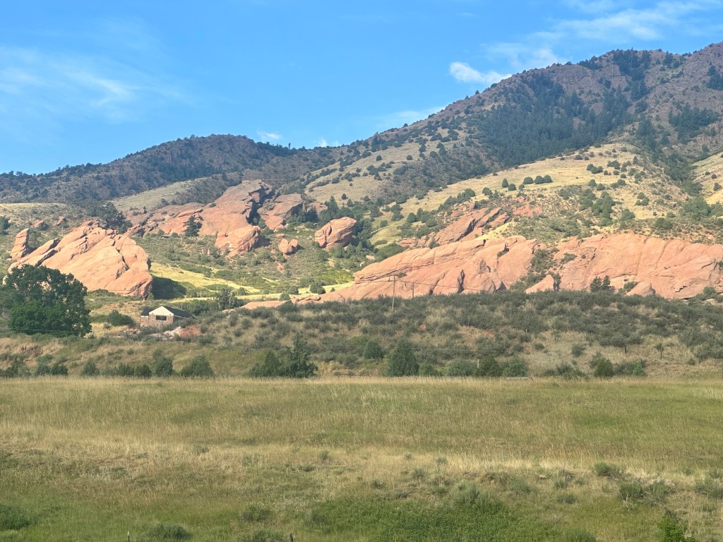
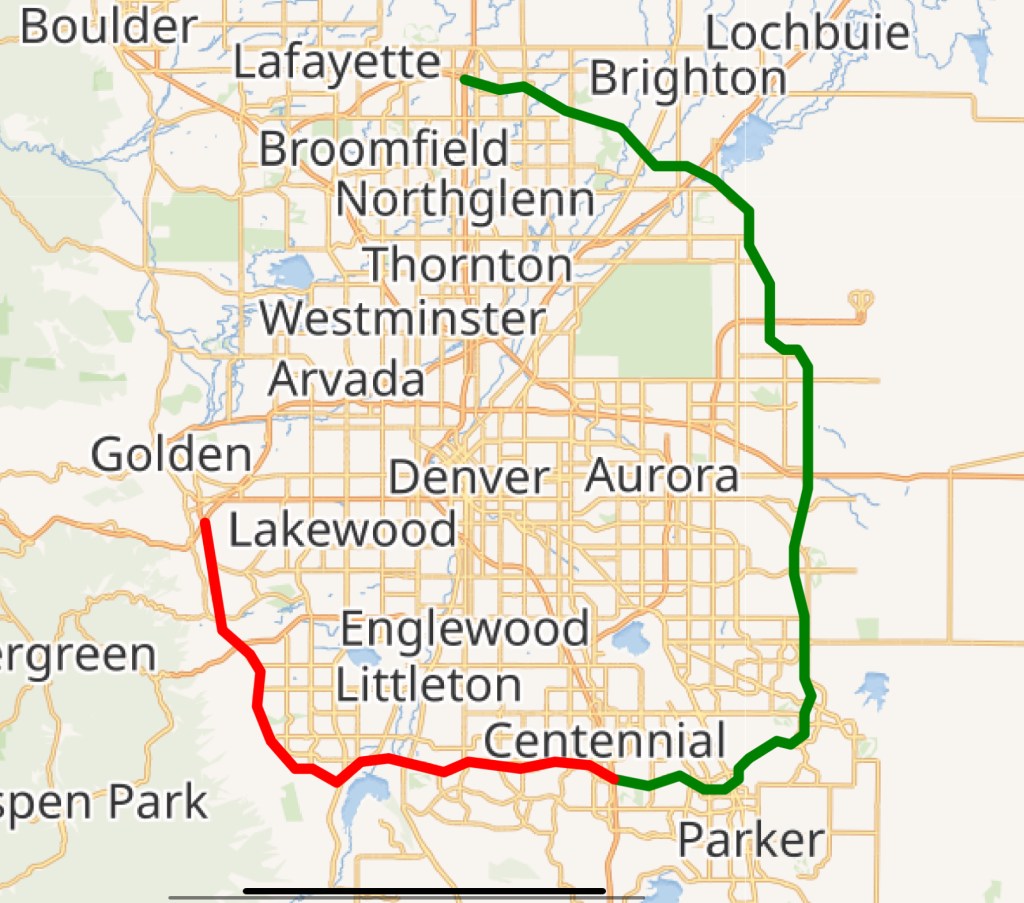
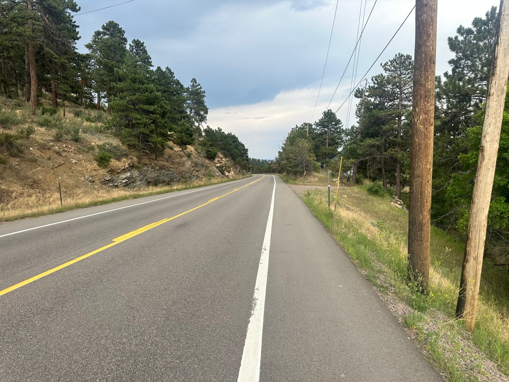
I’ve followed some of these routes, but still like ours the best. It makes maximal use of bikepaths such as the Cape Cod Rail Trail, the National Seashore and Cape Cod Canal bikepaths, the Emerald Necklace paths in Boston, and the D.W. Field Parkway in Brockton. Almost all of the rest is on quiet back roads, with very few stretches on busy arterials, most of these are encountered in the early morning when there is minimal traffic. The only dicey section is a 3 mile stretch along Route 6A in Barnstable and Yarmouth, the shoulder is marginal but this is part of the official Bikeway, and the motorists are generally quite tolerant. Every year we’ve tweaked the route, keeping up with bike infrastructure enhancements and updating maps, cue sheets, and most recently navigation software. There are hundreds of turns, I’ve curated the directions to eliminate any ambiguity or confusion, and even thrown in some fun facts. Here is the latest route, field tested just last May: https://ridewithgps.com/routes/50798046

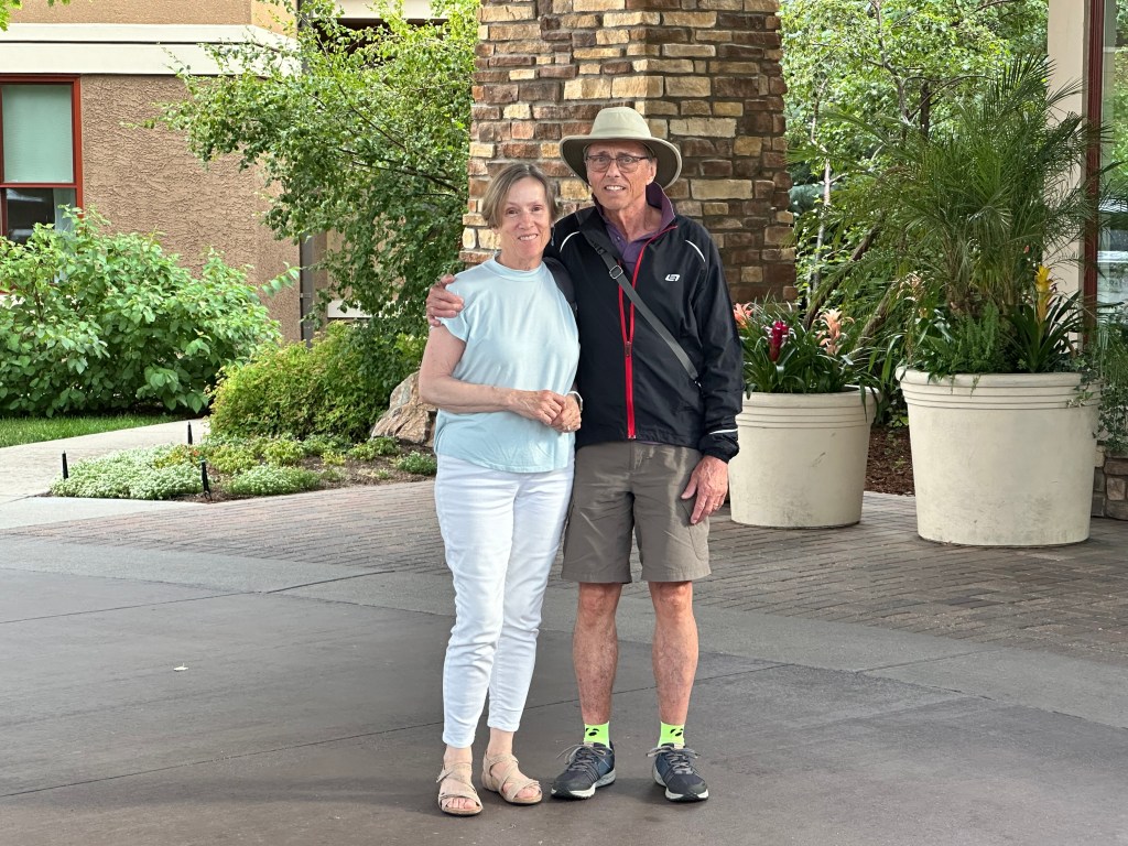
Irresistible. Sort of a greatest hits of the South Shore and Cape Cod. Mostly flat, with a few short hills. I can’t stop doing it. This year marks my 40th time (I skipped a few years when my children were born). Lately it’s just been me; older and fatter, I’ve slowed down and have had to take two days these last few years. 40 is a nice round number, I think from now on, I’ll do it on an E bike.

Alas, Dick is no longer with us. I mentioned his altruism and dedication to public service, in the early 90s he did a two year stint with the World Health Organization in Brazzaville, Congo, and contracted hepatitis C, which was endemic there. Nowadays the infection can be cured with a single sofosbuvir/velpatasvir tablet daily for 12 weeks, but back then all we had were injections of interferon and ribavirin. Dick gave these to himself weekly for years, they always made him feel punky so he skipped a dose when we took our annual bike rides. These delayed but did not halt the progression to cirrhosis, and he ultimately required a liver transplant. At that time, he was found to have a hepatocellular carcinoma (a known complication of cirrhosis) which responded to chemotherapy, but ultimately recurred, and he passed away on May 29, 2019.

So emblematic of his selfless dedication to help others, his noble efforts led directly to his untimely demise. A hero for the ages. I will continue these annual bike rides in his honor for as long as I’m able, with my thoughts full of how he enriched my life, and countless others. With due respect to Claire, I’d like to rename it the Dick Bail Memorial Bike Route. I encourage you to try it sometime. But watch out, it can be habit forming.

Cape diem

Random musings on Cape Cod. Saturday, July 26, 2025.

When most people in the US talk of the Cape, they mean Cape Cod. Certainly in the eastern US. It’s one of the most prominent features of the country’s outline, after Florida and the Great Lakes.

I guess you’d have to allow for Chesapeake and Delaware Bays, Long Island, and the Mississippi Delta

The distinctive silhouette is etched in the national consciousness, echoed in other iconic images

Most compelling of all is the smooth sweep of the Outer Cape, culminating in the fist, the spiral that is Provincetown.

It was my great fortune to have lived and worked in Provincetown for three years in the 80s, in the early years of the AIDS epidemic, paying back my commitment to the Public Health Service, which put me through medical school. A magic time: the people, the beaches, the lobsters, the oysters, the art— all suffused with that special light that comes from being surrounded by water.

From the classic Joel Meyerowitz photo album “Cape Light“

A “cape” is also a distinctive house, available in a selection of sizes, with or without dormers

Full Cape

I’m not a fan of EZ-listening music, used to call it “slush pump music”, but who can resist the smooth stylings of Patti Page’s classic Old Cape Cod? https://youtu.be/a34kIKVideI?si=Br5MCPbBqBrgXSnw


So yeah, the Cape has a grip on our national psyche. But how did this peculiar feature of geography come to be? While living there I hit the books (no internet back then), explored the National Seashore, talked with rangers, and hired a colorful local field botanist, Richard LeBlond, a middle-aged hippie who seemed to know more about the geology of the Cape than anybody, for many hours of walking tours.

It all started with our friends the glaciers, who gave us the drumlins of the last post. In the last Ice Age, about 20,000 years ago, the Laurentide ice sheet extended down past southern New England. Sea level was many hundreds of feet lower than today, the water tied up in the polar ice caps, so that what are now Massachusetts and Cape Cod Bays were dry land. As the planet warmed and the glaciers retreated, they left piles of rubble at their terminal and lateral edges called moraines. The first terminal moraine became Nantucket, Martha’s Vineyard, Block and Long Islands; the second terminal and lateral moraines formed the outline of glacial Cape Cod, surrounded by the rising sea level.

Retreating glaciers, leaving moraines

This blurry map shows the outline in green of glacial Cape Cod. You’ll note the outer Cape was much thicker, and did not extend to include Provincetown.

Wind and waves battered the Cape from the east, eroding the thick part and developing sand spits at the ends: Monomoy Island to the south, Provincetown to the north, which curled around. The erosion continues to this day, lighthouses and homes have had to be moved back, and the source of the Pamet River has washed away. Just like Mount Monadnock inspired the generic term monadnock for any isolated mountain not part of a range, the Pamet River gave rise to the term pamet for any river that has lost its source to erosion. This pamet has transected the entire Cape, which would have made the land north an island, had not the Army Corps of Engineers closed the gap at Ballston Beach.

Let’s take a closer look at Provincetown. Glacial Cape Cod ended at High Head, everything beyond is sand spit

the first sand spit curled around and formed Pilgrim Lake

which was the first Provincetown Harbor. When that closed off, new sand spits grew, curled around and formed new Provincetown Harbors, closing off in turn and forming a chain of lakes.

The lakes show up better in this photo, Pilgrim Lake is on the right

The current sand spit (Long Point) would curl around too and form another lake, were it not for ongoing efforts to stabilize it, including a dike.

The lakes on glacial Cape Cod were formed differently. They are kettle ponds, caused by chunks of ice breaking off from the retreating ice sheet, leaving voids in the moraine and later filling with water.

The Cape is dotted with hundreds of these, and parts of it look like Swiss cheese.

Kettle ponds in Wellfleet

Moraines, pamets, sand spits, kettles–and one more Cape quirk: erratics, which sound quirky all by themselves. I discovered these while trying to make a New England clambake for friends, where you make a big pit in the sand, line it with rocks, build a fire to heat them up, put the fire out, layer corn, clams, lobsters, and seaweed and cover with a tarp until the hot rocks thoroughly cook everything. The first step was to get a bunch of rocks, but I came up short. There are no rocks on the glacial Cape, just gravel and pebbles from the moraines. Only occasionally was a rock deposited by the receding glaciers, these were so rare they were called erratics. A stunning example is Doane Rock, near the visitor center in Eastham, the largest erratic on the Cape.

Doane Rock

None of these quirks detract from the seminal feature of the Outer Cape, the Great Beach, over 40 miles of unbroken (except for a few breaches from storms) pristine strand facing the broad Atlantic. So different from the congestion and commercialization of the Inner Cape; we have JFK to thank for that. One of his last acts as senator was to sponsor the Cape Cod National Seashore, signed into law shortly after he became president. You can still find disgruntled old-timers who deplore his land grab, call him a communist, but most of us are very grateful.

Long ago the Great Beach was feared rather than revered, it represented a major navigation hazard. No rocks to threaten shipwrecks, the vessels simply got stuck in the shifting shoals and were stranded many yards from shore. If the crew braved the waves to reach dry land they often froze or starved to death on the desolate beach, with no facilities for many miles. Lifesaving stations were set up every five miles with regular patrols meeting each other to look for stranded ships, then launching rescues with Lyle guns to shoot ropes into the rigging and bringing the men to safety via breeches buoys. A few of these stations remain, they were the precursors of the Coast Guard. https://youtu.be/n-dEWCUJJrI?si=uVaiWwBqH-C6U4cw (skip ahead to 6:30 to see a Lyle gun rescue).

The opening of the Cape Cod Canal in 1916 allowed captains to bypass the Outer Cape, and render the lifesaving stations obsolete.

We moved away almost 4 decades ago, but that enigmatic spiral keeps calling us back, not a year goes by when we don’t visit. It’s been the destination of an annual bike ride, the subject of my next post.

©️ 2025 Scott Luria

It’s all about the drumlins

The Battle of Bunker Hill. Tuesday, June 17, 2025.

It’s time I fessed up, I have a drumlin fetish. Having spent my wonder years in Boston, I became obsessed with these little glacial hills that dotted the landscape. You’ve heard of some of them: Beacon Hill, Bunker Hill, Winter Hill, Mission Hill, and most of the islands in Boston Harbor. They have a typical shape: about a mile long, oval, around 100 feet high, steeper on one side, typically pointing southeast, often occur in “swarms”.

Most of the ones in Boston have been adulterated, carved up by development, the top 50 feet of Beacon Hill was dumped into the harbor for landfill. Orient Heights in East Boston, just north of the airport, is a textbook drumlin, but darned if I could find a picture of it on the web, just this map from 1894.

Great Brewster Island in the harbor is another classic drumlin.

These little hills played an outsized role in the birth of our nation. Seizing the high ground, even ground as low as these, confers enormous strategic advantage. After the debacle of Lexington and Concord, British soldiers and loyalists were basically under siege, holed up in Boston, which then was almost an island, connected by a thin neck with a single road, surrounded by tens of thousands of hostile provincials. Their only lifeline was the sea, but that one was a doozy, the British Navy was unsurpassed in the world.

The British commanders realized that the closest hills, in Charlestown and on Dorchester Neck, represented a serious threat if occupied by the colonials. The night before the Redcoats planned to secure them, the provincials, tipped off by spies, worked all night to dig a crude earthwork on Breed’s Hill, #14 on the map. Sunrise on the morning of June 17, 1775 revealed to the outraged commanders that their plans had been co-opted, and the shelling started immediately. Most of the British guns couldn’t aim that high, and colonial fortifications continued. It took until 3 PM to land Redcoats in Charlestown, and march up the hill. It must’ve been a terrifying site to see. The rebels, low on ammunition, held their fire until they could see “the whites of their eyes”, but then unleashed devastating volleys. The British had to fall back, regroup, and try an additional two times before prevailing against the provincials who had completely run out of ammunition. The heroic Joseph Warren, whose spies had proved so crucial, was killed in that final assault. When the dust cleared on this first pitched battle of the Revolution, the British had “won:” they had seized Breed’s and Bunker hills, but at a cost of 1000 casualties, twice as many as the other side. General Howe, the new commander, deemed it “a prize too dearly won,” The rebels wished they “could sell them another hill at the same price.”

The other hill, obviously, was the one on Dorchester Neck, but Howe, perhaps chagrined by the earlier experience, dragged his feet about taking it. Meantime, the Second Continental Congress had appointed George Washington as commander of the newly formed continental army, and he arrived a month later to assume the ongoing siege. They decided a direct attack on Boston was too risky, but didn’t have artillery to secure the drumlin on the neck (now known as Telegraph Hill in South Boston.)

Enter three American heroes: Ethan Allen, leader of Vermont’s boozy Green Mountain boys, Benedict Arnold, a competent commander who had not yet turned traitor, and Henry Knox, a Boston bookseller. Allen and Arnold had captured Fort Ticonderoga, the “Gibraltar of the continent,” without firing a shot on May 10. Legend has it that Ethan woke the sleeping commander and demanded “surrender in the name of the Great Jehovah and the Continental Congress” but knowing Ethan, he likely said something more profane. Whatever, the stunning victory had netted the Americans some significant ordinance. Tasked with transporting the guns to Boston, Knox conducted the celebrated “noble train of artillery” over 300 miles unforgiving winter topography using oxen, sleds, boats, and sheer manpower.

By early March 1776, Washington had his ducks (or guns) in a row. In a hidden nighttime operation that rivaled what the provincials had done the year before on Breed’s hill, he fortified the Dorchester drumlin. Howe woke the morning of March 4 with déjà vu all over again, I love to picture him saying “D’oh!” Once again he launched an expedition to dislodge them, but a late winter storm kept him from landing, and each day, Washington strengthened his position. All of Boston Harbor was under his guns. Finally the British realized they had no choice but to leave. On St. Patrick’s Day, 1776, still celebrated in Boston as Evacuation Day, Washington entered the abandoned city, having won his first victory without firing a shot.

There are themes here: nighttime operations, sometimes bloodless battles, but to me, the liberation of Boston was all about the drumlins.

You know me, I couldn’t leave it at that. I “reenacted” the Battle of Bunker (really Breed’s) Hill by bike last month, not quite on the semiquincentennial. I knew better than to show up on the actual day. Every year, Charlestown celebrates Bunker Hill Day with a massive parade that circles the entire peninsula, traditionally attended by every politician in the state. One year I was trapped inside and couldn’t leave for hours. Today’s parade, I’m sure, will top them all.

The ride was low-key by my grandiose standards, just from my sister‘s place in Newton to the battlefield and back, stopping by Copp’s Hill (another drumlin) where the Old North Church is, the USS Constitution, and noting that, even at 73 feet, Breed’s Hill is a steep little sucker.

Kind of comical, really, the monument is three times as tall as the hill is high. I’ve been there before, but the tower was always closed. This time it was open, a chance to climb 294 spiral steps, getting more claustrophobic as the tower narrowed towards the top, and peek out the tiny windows. At the base, there used to be a terrific multimedia exhibit The Whites of Their Eyes, but that was a bicentennial project that closed years ago.

Returned via my favorite Cambridge bike shop, then got to bed early for my annual Cape Cod bike ride. The subject of my next post.

Distance 27.4 miles, time six hours. Elevation gain 752 feet.


©️ 2025 Scott Luria

Listen my children, and you shall hear

Boston to Concord, Massachusetts. April 18–19, 2025, revised June 14, 2025.

My terrific high school history teacher, Brooke Miner, took pleasure in deconstructing American heroes. George Washington never chopped down that cherry tree, Andrew Jackson was a ruthless Indian killer, Abe Lincoln suspended habeas corpus, Teddy Roosevelt didn’t ride up San Juan Hill, Woodrow Wilson (for whom our high school was named) was a misogynistic racist. She had particular disdain for the Midnight Ride of Paul Revere: he never made it to Concord, never shouted “the British are coming”, was only a small cog in the network of people spreading the alarm that night.

Yeah, but the legend endures, the focus of much of Boston’s Freedom Trail. Longfellow’s great poem, embellished though it was, was based on fact and captured the spirit of the moment, the birth of a nation. America’s image has taken quite a hit lately, but at bottom I still believe we are the last best hope of earth.

I felt that back in 1975, when I and my college dormmates decided it would be a hoot to re-create the ride on its exact bicentennial. Fortified by beer and coffee, we rode our cheap 10 speeds without helmets or lights from the Old North Church to the Concord Battlefield. We were rewarded with an all night concert featuring Arlo Guthrie, Pete Seeger, and Phil Ochs. It started to rain, and the six of us squeezed into a pup tent, surrounded by our bikes to keep from being trampled. At dawn we were shooed off the field to make way for the reenactment cannons and Gerald Ford’s speech.

Now, 50 years later, I felt compelled to repeat the ride. Another performative stunt, I suppose, but that seems to be my jam. Maybe it’s because I felt democracy is threatened, as it was 250 years ago, that it was time once again to spread the alarm. This time around, I have tried to research what really happened, compare it to the legend, and relive it in real time. I reached out to my dormmates, but suspect my emails went right to their spam folders. I had no better luck with my cycling buddies, who perhaps felt we were too old to be pulling all-nighters.

I looked for other mentions of the ride in popular culture, and found this song by Steve Martin and the Steep Canyon Rangers, told from the perspective of his horse, and much more factually accurate. https://youtu.be/ss038U9_8JA?si=RSPeXpJQKsAVgoUo

The National Park Service has a map that gives a good overview:

Right away, you can see that Revere wasn’t the only rider that night. William Dawes departed at the same time, taking the longer “land” route via Boston Neck. His unfair lack of recognition was lamented in an 1896 poem by Helen Moore.

At least Dawes got a little street cred, his hoof tracks through Harvard Square are preserved in bronze.

The mastermind behind these rides, this “alert,” was Joseph Warren*, a physician who was as active in the revolutionary cause as Samuel Adams and John Hancock. The latter two were visiting a cousin at the Hancock-Clarke house in Lexington, and Warren’s spies discovered the British commandant General Gage’s plan to arrest them and seize an ammunitions depot in Concord on the night of April 18, 1775. It was Warren who dispatched Revere and Dawes to warn Adams and Hancock and rouse the Minutemen, and who devised the “one if by land, two if by sea” signaling system at the Old North Church.

We should take a step back here to get the historical context. Why this “revolutionary cause?” Why the need to seize munitions? As I looked back from the present, I try to understand what was going on in the Massachusetts Bay area back then. The colonies had been content, the colonials proud to be Englishmen. What happened?

In the end, it was all about money. England was deep in debt from the Seven Years War, a.k.a. the French and Indian War. They had emerged victorious, conquered all of France’s holdings in North America, and reigned supreme as the greatest superpower on earth, but at a huge monetary cost. They took the national debt seriously back then. Since the war had been fought largely to protect the colonies from the French and the indigenous peoples, the king and Parliament thought they should share in the cost. The tax they levied was modest and reasonable, but was done without consulting the colonials first. This rankled the settlers, who felt their right to representation in governance dated back to the Magna Carta and the Mayflower Compact.

You probably know the progression—the Stamp Act, the boycotts, the Intolerable Acts, tarring and feathering of tax collectors, the Boston Massacre, the Tea tax, the Tea Party— a spiraling sequence of confrontations that resisted attempts at compromise and ultimately led to the declaration of martial law in Boston, the shutting down of local governments, and the occupation of the city by Redcoat regiments. The First Continental Congress in Philadelphia extended an Olive Branch Petition that was inexplicably ignored by the king. How could he have squandered a chance for a simple solution? There is evidence that he suffered from porphyria, a hematologic condition that can cloud the judgment cause frank psychosis, the “madness of King George.” Whatever, by that April night things were approaching the point of no return.

This April night I biked from my sister’s house in Newton to downtown Boston and followed the Freedom Trail to Paul Revere Mall and the Old North Church


where the crowds were treated to a performance of Revolution’s Edge, a costumed play featuring a patriot, a loyalist, and a slave

followed by remarks from the mayor and the governor. Afterwards, we were invited to create our own paper lantern and join the procession following Revere’s route to the harbor, attend a special service witnessing the iconic two-lantern signal lighting the steeple

Couldn’t catch the lanterns in this view

watch a dramatic reenactment of Revere’s crossing with music and a drone light show


And see Paul taking off down the streets of Charlestown

WordPress won’t let me embed videos, so this blurry picture is a screenshot of a single frame.

In Revere’s journal, he said he left around 11 PM, and after passing Charlestown Neck, turned left to head towards Cambridge and the main road to Lexington. But at a spot where “Mark hung in chains” (where a slave who had been executed 20 years before was still hanging, his decomposed corpse a grisly example) he encountered two Redcoat officers who gave chase; he had to backtrack and head for Medford instead, barely eluding capture. I found a monument marking the spot in front of a Holiday Inn.

He never yelled “the British are coming” since everyone considered themselves British, and shouting would have attracted the attention of the patrolling sentries. Instead, he stopped at houses and warned the occupants quietly. I followed in his wake, dodging the late night traffic, and stopping at the home of Isaac Hall, captain of the Medford Middlemen, which is now an Islamic cultural center.

He reached the Clarke house in Lexington in the early morning, and warned John Hancock and Samuel Adams that soldiers were coming to arrest him.

The reenactors arrived at the Clarke house ahead of “schedule”, 10:30 PM. I got there at 12:30, closer to the actual time, the crowds were all gone.


Revere and Dawes rode on towards Concord, but were intercepted by British soldiers a couple of miles down the road, Revere was captured, Dawes turned around, but a third rider, Dr. Samuel Prescott, who had joined the group after making a scandalous late night visit to his lady friend in Lexington, managed to elude the soldiers by jumping over a stone wall, and made it to Concord. So the famous Midnight Ride was completed by a Lothario.

I decided to stick around and watch the reenactment at Lexington, they have one every year, but this was supposed to be the most elaborate ever. It began at 5:15 AM, but they said to arrive a couple of hours early to have any chance of getting a spot where you could see. Sure enough, by 1 AM there were already a couple of hundred people clustered around the viewing area, many with sleeping bags or lawn chairs. I had nothing but a 1-foot square “butt pad” and settled down against a tree, just like Rip van Winkle did all those years ago. He caught a lot more than 40 winks, woke up to find he had missed the entire American Revolution; I was hoping to just get a couple of winks.

It was not to be. The crowd steadily filled in around me, kept tripping over my legs, and a very knowledgeable reenactor stopped by the barricade, and gave an excellent history lesson— with the result I got no sleep at all.

If the Revolutionary War, if “America” had a starting point, it was at Lexington. It’s not that simple of course, but John Parker’s words resonate: “Stand your ground. Don’t fire unless fired upon, but if they mean to have a war, let it begin here.” I passed his heroic statue at the apex of the green on the way to my “resting place.”

The statue often confused with the “Concord Minuteman” statue at the Old North Bridge (which I’ll be visiting later this morning) by Daniel Chester French, who also sculpted Lincoln at the Memorial, and John Harvard in the Yard.


Ralph Waldo Emerson’s Concord Hymn appears below it, with the famous line “the shot heard around the world.” But where was that shot? There was certainly gunfire hours earlier, in Lexington. Who fired it?

I read and researched extensively before my little ride, and was gratified to see the reenactment was as historically accurate as I could determine. Certainly worth waiting for. As I rose on my aching bones from under that tree, there were five packed rows ahead of me, and many thousands crowded around the green, with Jumbotrons erected for the people in back. My height counted for something, and I tried to take a video, but the woman in front of me kept hoisting her child on her shoulders. This clip from YouTube shows it much better anyway. https://youtu.be/Rgl49Wkkz4E?si=bREGcqOExD9s4j5E It’s quite long and worth watching in its entirety, but the main action begins at 7:30 when the mysterious first shot rings out, followed by panicked general fire on both sides, with the British officers desperately trying to control their men who were running amok. Equally compelling was 10:30, when the officers realized the countryside had been alerted, the mission had been compromised, and that they should go back to Boston. They were overruled by their commander, with devastating consequences.

When the smoke cleared, there were eight Colonials dead.

The battle was immortalized in the song “Mama Look Sharp” from the musical 1776. I can’t listen to it without misting up. The YouTube clip omits the preamble:

You seen any fighting?

Sure did. I seen my two best friends get shot dead on the very same day. And at Lexington it was, too. Right on the village green. 

When they didn’t come home for supper, their mamas went down the hill looking for them. Mrs. Lowell, she found Timothy….right off. 

But Mrs. Pickett, she looked near half the night for William. He went and crawled off the green…before he died.

By now I was running on fumes, but pushed on to Concord, passing the Paul Revere capture site

the reenactment at the Old North Bridge, less well done than at Lexington

No rock concert this time, and no way was Trump going to show up in this deep blue state.

The battle at Concord was kind of a draw. The alerted villagers had moved their ammunition stockpile, the British could only find a few weapons and set those on fire, the militias in the hills beyond saw the smoke, thought the troops were burning their town, and advanced across the bridge. Losses were fairly light on both sides, but the British decided to withdraw.

That withdrawal, the least-known part of the battle, was where most of the casualties occurred. Retracing their steps along the “Battle Road” preserved as Minuteman National Historic Park, the Redcoats were continuously harassed by the enraged colonials, whose numbers had swelled to many thousands, firing from behind trees and stone walls, guerrilla warfare really. The British were equally furious, they had started their mission soaking wet after disembarking from their boats in a swamp, had marched 20 miles and having failed in their objective had to retreat 20 more under unrelenting fire, which they felt was cowardly, their opponents not coming out into the open. Their losses on a hill dubbed Parker’s Revenge were particularly devastating. Emblematic of their fury was there treatment of an 80-year-old resident of Menotomy (now Arlington).

When all was said and done, the British expedition, designed to discipline the upstart provincials and show them who was boss, had the opposite effect, and sent the country down the road to independence. The numbers tell the tale.

My expedition was a lot less traumatic.

  • * Joseph Warren was killed in the Battle of Bunker Hill, as you will see in my next post. His younger brother was a founder of Harvard Medical School, and his nephew helped to start Mass General Hospital, which has a building named in his honor.

Grover and the Guy

One of them blue states. Wednesday, November 6, 2024

Flashback: February 28, 1984.

I’d been married for just a month. BFF Brian and I were scoping out offbeat New Hampshire roadside attractions, and stumbled upon the Tilton Arch,

the grandiose mausoleum of a delusional developer who thought he could found a great city in the backwoods of the Granite State. It was snowing, and from the hill we could see the main street of the eponymous town, with people going in and out of the municipal building. It was the New Hampshire primary, and later we heard that Gary Hart had upset Walter Mondale, and turned that election on its ear. It was a weird feeling, to think we were witnessing history.

It was with that in mind, to witness history, that I got up early yesterday to take a one-day bike tour on Guy Fawkes Day.

Not being a Brit, I’d never heard of Mr. Fawkes, and was mystified by the explosive ending of Lennon’s Remember, from the first (and some say the best) of his post-Beatles albums https://youtu.be/KIn6kDnmSLs?si=gHp1ob57s4xtL26k, so I looked it up. “Remember remember the 5th of November,” went the chant, referring to the day in 1605 when Guy was discovered guarding a pile of gunpowder stashed under the Houses of Parliament. He and his Catholic cronies were arrested and tortured, and confessed to planning to blow up the Protestant King James I and his government. They all suffered grisly executions, but the Gunpowder Plot achieved mythic status over the centuries as a symbol of resistance, and Guy Fawkes Day celebrations endure with fireworks, burnings in effigy, and children running around begging for “a penny for the Guy”. Guy Fawkes masks remain as emblems of social protest, popularized by the 2005 movie V for Vendetta.

Anyway, it seemed portentious that this year’s elections fell on that day, a day that might have profound historical significance, a day that democracy might get blown up. I’d already voted, but decided I wanted to see as many polling places as possible. There are 28 such places in Chittenden County, and I could see 23 of them on an 88 mile e-bike ride. I started early, so I could catch the first one when the polls opened at 7 AM. Here’s my route

and photos of the 23.

OK, OK for you sticklers out there, the Burlington and South Burlington wards were numbered differently. There were a couple of Easter eggs: A 10 second clip on a cable access channel,

a chance encounter with Bernie Sanders as he came out from voting at Burlington’s Ward 7, surrounded by reporters,

We even had a “conversation”. I called out “Good luck Bernie” as he was walking away, and he waved back and said “Thank you”.

The last stop of course was my home polling place of Williston, where I’d already voted by mail. I chatted with my neighbor Nancy Milne, and realized belatedly that perhaps my time might’ve been better spent helping out at the polls.

Anyway, I got there just before the polls closed at 7 PM, then rushed home to watch the evenings’s grim events unfold on television. I don’t know what I was thinking. Perhaps by bearing witness, I could safeguard democracy? There was no doubt that Vermont was going for Harris, indeed it was the first state to do so. I’d spent the weekend knocking on doors in Greensboro, North Carolina; fat lot of good that did.

Some of the thousands 🙄 of you who follow this blog might remember my post from May 1, 2021, when I stopped by the statue of Grover Cleveland in Buffalo.

At the time, my comment was “Grover Cleveland …is (so far) is the only president to serve two non-consecutive terms, he was our 22nd and 24th president. Jury is still out whether his feat will be matched in 2024 by our most recent NY president.” Well now the jury is in, we have a 45th and 47th, and it feels appropriate to compare them. We all know who 45/47 is but let’s look at 22/24.

Except for that one numerical quirk, most of us know nothing about Grover. He was one of that great unremarkable blur of presidents between Lincoln and Teddy Roosevelt, the captains of Reconstruction and the Gilded Age. Most of them have sunk into the obscurity they so richly deserved, although Grant, Garfield, and McKinley got a little traction, mostly due to scandals and getting assassinated. Grover stood out as the only Democratic president between the Civil War and World War I, a span of 52 years. He won the popular vote in his first reelection, but lost the electoral vote and left graciously, his wife telling the White House staff, “don’t change anything, we’ll be back.” Four years later he was, having won both popular and electoral votes that time. His second term was notable for the Panic of 1893 mentioned prominently in my blog posts about the Aspen area, and for having a large tumor on his palate removed in secret, on a boat cruise. Wikipedia states “Cleveland is praised for honesty, integrity, adherence to his morals, defying party boundaries, and effective leadership, and is typically ranked in the middle to upper tier of U.S. presidents.”

Ol’ 45/47, not so much. But we can’t deny that he won, and won decisively. The reasons why are the subject of much hand-ringing and recrimination, to which I have a little to add. The man’s slew of negatives are self-evident, I won’t enumerate them here. Over the decades, with the election of Nixon, Reagan, the Bushes, and Trump the first time, I mused about leaving the country. This defeat is the most unsettling of all, since many of the constitutional guard rails have disappeared. I was born in Germany, wouldn’t be too hard to get a passport. Canada and New Zealand also beckon.

But no. If I learned nothing else in my fractured but complete trip across the country, it’s that the vast majority of people are reasonable, decent, and well-meaning, even in the deep red states. Everybody knew who Trump was, all of his baggage, and the majority decided that on balance, he was the better choice. It’s tempting to dismiss them as ignorant, xenophobic, misogynistic, and racist, but that’s not what I saw on that trip. From my comfortable, elitely-educated, cloistered perch, who am I to be so judgmental? Isn’t that what we were accusing Trump of doing, vilifying the opposition as “the other”?

Folks have been quoting Ben Franklin recently: “A Republic, if you can keep it.” To which I might add: a planet, if you can keep it.

One can only hope.

Distance 88 miles. Time 12 hours with stops. Elevation gain 4,650 feet

©️ 2024 Scott Luria

Dénouement

Greenwood Village, Colorado to Williston, Vermont. Sunday- Friday, July 21-26, 2024

It was a quick ride to the third couple to host me in the Denver area, who would prefer I didn’t use their names. He is a retired neurologist and Colorado native, also an avid fly fisherman and llama wrangler, who has a herd of about 60 of these beautiful animals, he took me to his ranch in Larkspur.


I’ve known his wife for 57 years, we went to high school together and both were in college in Cambridge, both pursued careers in medicine. Although we live far apart, we have shared so many of life’s experiences and had so much to talk about. Visiting with them was the pièce de résistance of my journey, the cherry on top of the dessert that was Denver.

It was over all too soon. I got to finish with a flourish: the Cherry Creek Trail, which sets the standard for bike paths. Beautifully paved, it follows the creek on a gentle downhill from the leafy suburbs to the heart of downtown Denver with nary a street crossing, completely protected from all that traffic. I was at Union Station in a flash.

I chose the train rather than flying, much easier to take an unboxed bike, far less carbon impact, and the romance of riding the rails has always appealed to me, especially in a sleeper car. It takes longer, but I’ve got the time. A six hour layover in Chicago gave me another look at the Windy City, such a contrast to the months of the Wild West.

The Sears/Willis Tower, once the tallest building in the world.
The Chicago River, connecting the Great Lakes with the Mississippi, home to dozens of cruise boats
My real destination
I can see the Roman “U” on the historic entrance, but it looks pretentious on a modern sign
My first Broadway play was Sondheim’s Sunday in the Park with George with Mandy Patinkin and Bernadette Peters, based on Seurat’s A Sunday on La Grande Jatte
Hard to articulate why I’ve always found Edward Hopper’s Nighthawks so eerie and compelling
The models for the couple are Hopper himself and his wife Jo

My God, am I really that old? I first became aware of Grant Wood’s American Gothic in a 1963 ad for New Country Corn Flakes. https://youtu.be/OKSmj2g8shs

So that was the trifecta of classics I came to see at the Art Institute, but you always find hidden nuggets. I knew this disturbing work, The Rock, was by Peter Blume,

Since it resembled his creepy Tasso’s Oak

which affected me so deeply I sought out the Oak itself, on the Janiculum Hill in Rome on our trip to Italy in 2022.

under which the Renaissance poet Torquato Tasso spent the last year of his life waiting in vain for the pope to recognize him as poet laureate, and slowly going mad.

Other nuggets were evocative of BFF Brian’s local mountain, Mount Equinox

and one of his wife Mary’s favorite paintings by Mary Cassatt.

Back at the station, I saw that Steve Goodman/Arlo Guthrie weren’t just blowing smoke, there really is a train they call the City of New Orleans.

So much more to see, so little time. What a sublime, refined coda to my three months of the rugged outdoors, a closure of sorts. I feel I am really done. I have, in three stages, cycled across the country, from the Atlantic to the Pacific. I didn’t reach any new highpoints this time, but I’ve sea-to-summited 26* of them, out of 37 total. I’ll get the last 13, but no longer feel the need to do these solely under human power, from the sea. I hope to post an epilogue soon, reflecting on the full experience.

I’ve visited family and many friends, old and new. I’ve been blessed by trail angels and Easter eggs, almost beyond counting. I’ve watched the tapestry of our nation roll by in slow motion, gaining new perspectives on scenes of exquisite beauty. I’ve seen, almost without exception, that folks are basically decent and caring. So reassuring, in these times of strife and polarization. I’ve lost 35 pounds, and never felt healthier. To use Simon and Garfunkel’s overworked lyric, I’ve come to look for America. It’s there, and it’s doing OK.

And that will be enough.

Distance 50 miles, 3,156 total. Time 10 hours with stops. Elevation gain 1,503 feet

©️ 2024 Scott Luria

*I know, at Mt. Elbert I said the total was 24. But I realized I could cobble together a series of rides and hikes that put Mount Mitchell and Clingmans Dome, the highpoints of North Carolina and Tennessee, also in that category. So I’ve done half of the state highpoints from sea-to-summit.

The animal

A few weeks back, I did a detailed post about my bicycle called “The machine.” Now it’s time to post about the blob of protoplasm pushing on the pedals. Heads up, it’s a long one.

I wanted to call this post “The modified limited hangout route”, inspired by this hilarious exchange caught on tape in 1973 as Nixon and his deputies try to figure out how much of the Watergate story to tell.

Nixon: “You think, you think we want to, want to go this route now? And the – let it hang out, so to speak?”

Haldeman: “It’s a limited hang out.”

Dean: “It’s a limited hang out.”

Ehrlichman: “It’s a modified limited hang out.”

I’ve never been much for privacy. My life is so boring, I sort of pity anybody who would want to pry into it. Knock yourself out. But I thought it would be interesting to come clean about my body and its medical problems. Let it all hang out, in a modified limited way. As a medical educator, I hope it will be useful to explain these common conditions, and the medications I take for them.

Ruptured disc/S1 radiculopathy. Like most Americans, I suffered from low back pain much of my life. After a particularly vigorous bike ride, the pain took longer than usual to go away, and I suddenly noticed I couldn’t walk on tiptoe. My ankle jerk reflex was also gone, and I was numb on my lateral left foot. I knew what I had before we got the MRI.

The first sacral nerve, or S1, exits the spinal cord and passes between the fifth lumbar and first sacral vertebrae, going right by the L5/S1 intervertebral disc (discs are the fibrocartilaginous cushions between the vertebrae.) This is the most common disc to rupture, and if it impinges on that nerve, you get some or all of these symptoms. Ruptured discs commonly resolve with conservative care, and I gave it 12 weeks. When I finally had surgery in 2001, the orthopedist commented that my nerve looked pretty beat up. Seven years later, I had similar symptoms on the other side, and this time I wasn’t waiting. I got the MRI on Tuesday, surgery on Wednesday, and was back at work the following Monday.

The pain was never very problematic, what I missed was the motor function of that nerve, which supplies the gastrocnemius muscle in the calf. Now, over 20 years later, I have only 10% of the strength in those muscles I used to have. My lower legs used to look like 10-pins, now they’re more like candlepins. My hiking and biking speed diminished accordingly, I joke that I’m only hitting on two cylinders. This new dropper post is making me pedal in a different way, use my ankles more, and this might constitute belated physical therapy, restoring some of the strength. But I’m not holding my breath.

I should caution people about rushing to MRI for back pain. In one study 100 healthy people with no back pain had MRIs, and 50% of them had ruptured discs. It’s an occupational hazard of being a bipedal primate, we stood up on our hind legs before our spines had evolved. Surgery never makes sense for ruptured discs that don’t correspond to a specific neurological syndrome, in fact it often makes things worse. Conservative care is the treatment of choice in most cases. I was just one of the unlucky ones.

I take no medications for this. When I was in the throes of my second ruptured disc, I staggered maximum doses of ibuprofen and acetaminophen, which controlled the pain and let me do a major hike. It was when I got down that I discovered I had the disc rupture. Pain meds are only a Band-Aid for back pain, they don’t alter the course of the condition, and they can mask important symptoms, never mind the huge risk of side effects and medication dependence. And for me, I feel worse when the medication wears off than I did before I started it. I did the entire Camino with a fair amount of musculoskeletal pain, but never took a single med. Typically, the pain would just ease with ongoing exercise.

Hypertension/cardiovascular risk. Heart disease does not run in my family, I have never smoked, don’t have diabetes. But as an internist, I’m aware that heart attacks and strokes are the #1 and #3 killers of men in this country. On a number of occasions I’ve had odd sensations in my chest that I thought were not cardiac, but confirmed with stress tests and stress echocardiograms, all negative.

Just before I retired in 2020, I noticed my blood pressure was running a bit high, I got a home cuff and found I was averaging about 142/85. Though I could be better with my diet, my exercise is quite good and I felt I was doing a reasonable job with nonpharmacologic management. Well over half of American men over 60 have hypertension, and should be on medication. Ongoing research has demonstrated the goal should be under 130/80.

There are many medications to control hypertension. Diuretics cause the kidneys to lose salt and fluid. Beta blockers slow the heart rate and contractility. Calcium channel blockers relax the smooth muscle in the walls of your small arteries (arterioles), and relieve pressure by vasodilation. It’s like trying to reduce the water pressure in your house, you can either bleed off fluid, turn down the pump, or open up all the spigots.

All of these medications have side effects. A relatively new approach is to target your body’s hormone angiotensin, which raises blood pressure by constricting blood vessels and causing the kidneys to retain salt. Angiotensin can be reduced by inhibiting the converting enzyme (enzymes are proteins your body makes that catalyze or facilitate chemical reactions) that activates it with angiotensin converting enzyme inhibitors, or ACE inhibitors. Unfortunately, these cause a cough in over 10% of patients. Easier to tolerate are angiotensin receptor blockers (ARBs), which block the effect of angiotensin on the blood vessels and kidneys. I take the ARB olmesartan (Benicar) and have tolerated it well, with good effect on the BP.

The other cardiac risk factor to control is cholesterol. My numbers have always been quite good, but not perfect. An evidence-validated tool is the ASCVD risk calculator. https://tools.acc.org/ASCVD-Risk-Estimator-Plus/#!/calculate/estimate/ My risk of a heart attack or stroke in the next 10 years was in the 10-15% range, high enough to merit statin therapy.

Statins reduce cholesterol by inhibiting the enzyme that synthesizes it, HMG-CoA reductase. It is the rare man over 60 who would not benefit from them. Well over 30 years of research have borne this out. Statins are so commonly prescribed that their side effects get a lot of press, and many are leery to take them. But the vast majority can tolerate them without difficulty, and substantially reduce their cardiac risk. I take atorvastatin (generic Lipitor) 20 mg daily. My cholesterol plummeted, as it always does, but more importantly my risk improved. Zero side effects, I just have to avoid grapefruit, which interacts with the enzyme.

Celiac disease. I’ve been giving blood for years, but lately was rejected because my hemoglobin was too low. Not uncommon, figured I would just stop donating, and take an iron supplement.

But it didn’t get better, and my ferritin level, a more accurate measure of iron stores, was half normal. That’s alarming in a male, suggests that I am losing blood somewhere, most commonly from the G.I. tract. Ugh. That meant I needed a colonoscopy and an upper endoscopy, looking for a bleeding ulcer or tumor.

My sister has celiac disease, and it runs in families. With great reluctance, I asked for the screening test, Tissue Transglutimase Antibody (TTAb), even though I had no symptoms. It came back 10 times normal. I was reasonably awake during the upper endoscopy, and saw the duodenum (upper small intestine) looked grossly normal, but biopsies were taken.

I was waiting in line at Starbucks when the email came with the results. I ate the croissant anyway, possibly my last one, and insisted on reviewing the slides with the pathologist face-to-face.

Your small intestine, you may remember, is where most of your food gets absorbed. To increase the surface area, it is lined with finger-like projections called villi. People with celiac disease have an allergy to gluten, a protein in wheat, rye, and barley that causes small intestinal inflammation which gums up or obliterates the villi.

My slides looked similar to those on the bottom.

In medical school we were taught that celiac disease (AKA sprue) was rare, causing severe malnutrition and making one poop vast quantities of fat, called steatorrhea. Since then we’ve found that the estimated global prevalence of celiac disease based on serologic studies is ~ 1 percent, and that most people have milder symptoms. In my case, the only symptom was not being able to absorb iron. Reluctantly, I started avoiding gluten, didn’t really feel any different, although a long-standing symptom, night sweats, went away. A hematologist later confirmed he has seen this commonly. The condition is improving, but not completely. I must confess I am not 100% adherent to the diet, it’s especially challenging when on the road and eating primarily out of convenience stores. I continue to take iron daily, and have had infusions of intravenous iron.

Gastro-esophageal reflux disease (GERD). I’ve had heartburn most of my adult life, along with 50% of the population. It didn’t get much better on the gluten-free diet. Endoscopy did not show anything worrisome, but I found I need to take a proton pump inhibitor (PPI) to control my symptoms.

I’m “sure” you remember from chemistry class that acids are basically free protons (hydrogen ions), hydrochloric acid in this case, secreted by cells that pump those protons into your stomach.

Those pumps are powerful, the pH (the negative logarithm of hydrogen ion concentration) of stomach acid ranges between 1 and 2, low enough to eat through bone—your gastric lining protects your body from its corrosive effects. PPIs mitigate this acid production, I take omeprazole (Prilosec), at one time the most prescribed medication in the world, along with calcium carbonate (TUMS) at bedtime.

PPIs are generally quite safe, though there’s some concern about an association with dementia. I do the NYT crossword daily to make sure I’m not losing it. Speaking of losing it, weight loss would help my GERD.

Hair loss. At age 47, friends were telling me I was getting a little thin on top. By then minoxidil (Rogaine) was generic and cheap. Once prescribed as a last-resort hypertension medication, minoxidil caused lots of side effects, one of which was hair growth. Applied topically, it acts as a vasodilator, improving blood flow to withering hair follicles. It works best for vertex baldness, avoiding the Friar Tuck look.

More recently I noticed my hairline was receding in a widow’s peak or male pattern baldness pattern, with testosterone having a significant role. In the 1990s, an anti-testosterone drug, finasteride (Proscar, a 5α-reductase, interferes with the last step of the hormone’s synthesis) was introduced to mitigate prostate swelling and symptoms. Like minoxidil, hair growth was noted as a side effect, and took place even at a fifth the dose (1 mg) with less sexual side effects. Finasteride was rebranded as Propecia, the patent renewed, and the price jacked up. Currently it’s $319 for a 90 day supply, not covered by insurance, since it’s a cosmetic drug. But the original Proscar has been generic for years, retail cost $4 for a 90 day supply. I just take one tablet every five days.

I’m not sure my hair has gotten any thicker, but it doesn’t look bad for someone who first noticed hair thinning 26 years ago. The Friar and the widow seem to be held at bay.

So for a healthy guy who doesn’t like taking drugs, I’m on quite a list of medications: olmesartan 40 mg, atorvastatin 20 mg, omeprazole 20 mg, iron 65 mg, calcium carbonate 400 mg, all daily; finasteride 5 mg every five days, and topical minoxidil daily. Total cost about $10 per month, no side effects, still able to do things like this bike trip.

I guess the point of this “modified limited hang out” is to show that older folks needn’t fear medications, in many cases the cost and side effects are minimal, and hardly limiting at all. Meantime, quality and length of life can be significantly improved.

©️ 2024 Scott Luria

Floyd Joy, and 2 Karens for the price of 1

Highlands Ranch, Colorado. Friday – Sunday, July 19–21, 2024

One of the more obscure Supremes songs, but one that sticks in my mind, is 1971’s Floy Joy. One of my favorite groups is Pink Floyd. It all fits, since my longtime buddy and med school classmate Floyd Russak is quite musical. He plays the guitar, and over the years we’ve had fun singing songs together.

I mentioned him three years ago, when I was riding by Northwestern University in Illinois. where Floyd met Karen while they were undergraduates, they both came to DC to attend George Washington University, he in the medical and she in the business school. We were quite active in left-wing politics together back then, both in the public health service, we paid back our scholarships in Massachusetts, after doing internal medicine residencies in separate hospitals in Cambridge. Floyd is a native of Colorado, so he returned here and began a series of private practices. The first was a fusion of eastern and western medical philosophies, he worked in an ER in Aspen (and purchased a couple of hotel rooms there, he put me up in one of them), and now he has a concierge practice. Karen manages the business of both the practice and their beautiful home. By happy coincidence, that home is right across University Boulevard from the CCRC where Steven and Karen Moore live. Two of my favorite couples, right across the street from each other, having arrived from far away. How lucky is that?

The Vi complex from Floyd and Karen’s deck

Floyd and Karen had to work Friday, so I took a leisurely ride on the meandering Highline Canal to check out his practice. The Highline Canal is a dream—flat, beautifully landscaped, reminiscent of my beloved C&O Canal, but in much better shape.

Not the most direct route
But what a delight to ride
That’s Kimberly, his clinical assistant

We had dinner that night in Le French, which was just as magnifique as it sounds.

Oh là là !

Saturday, at another posh restaurant, Sierra

I finally got a chance to see these wonderful friends, who live so close but have never met, get together.

Steve, Karen, Karen, and Floyd.

We moved on to Lookout Mountain, 2,000 feet above the city, for the Buffalo Bill Museum and grave.

“Bill” and Annie Oakley. Maybe you CAN get a man with a gun?

There’s some controversy about whether he is really buried here, or in the town he founded, Cody, Wyoming, that I visited a month ago. https://history.denverlibrary.org/news/western-history/buffalo-bill-cody-really-buried-lookout-mountain

Then it was off to another echo of previous places. Three years ago, I passed Chautauqua, New York, and ruminated about the central a role it played in my life, and how it spawned the Chautauqua movement. Three weeks ago I encountered a remnant of that movement, the Tank Center for the Sonic Arts, in Rangely Colorado. Now Floyd and Karen treated me to a terrific concert from the a cappella group Straight No Chaser

These guys have to be seen to be believed. Incredible.

at the Colorado Chautauqua, the only other permanent Chautauqua in the country. https://www.chautauqua.com/2021/chautauqua-movement-history/ Just seeing the name, and the logo, brought back such warm memories. Such a night.

The next morning, we sang songs together, shared stories, and I said goodbye to the Russak family.

Daughter Emily, boyfriend Dave, Floyd, and Karen. Thanks guys!

No cycling or hiking these two days, just sightseeing and schmoozing. Heaven.

©️ 2024 Scott Luria

Switching gears

Golden to Highlands Ranch, Colorado. Monday-Thursday, July 15-18, 2024

After more than 3,000 miles, the trip is winding down. The feast is almost over, now comes dessert. Golden is at the doorstep of greater Denver, today is just 30 miles to the first of three sets of friends I’ll be staying with here.

One more bit of descending, past the famous Red Rocks Amphitheatre, often called the country’s greatest natural outdoor concert venue. Could only see this glimpse from the road

but I’ve been to a concert there, and wow what a place.

Photo from the web of a yoga session

The venue is best recognized by its two massive monoliths, named “Ship Rock” and “Creation Rock”, as well as the smaller “Stage Rock”, which together flank its 9,525 capacity seating area and naturally form the amphitheater. Many of the biggest bands have played here, most notably the Beatles in 1964.

That descent led me to the cute little town of Morrison, then onto the C-470 bike path.

C-470 (in red on the map above) is the southwestern segment of Denver’s incomplete beltway. Originally planned to be I-470, the full beltway was never completed for environmental concerns, but 3/4 of it was later finished by the state, the green portion is designated E-470. Most beltways are dreary-but-essential thorofares through suburban sprawl, but C-470 is a scenic wonder, skirting the foothills of the Front Range and offering dazzling views throughout. The associated bike path was a dream to ride.

At least until I hit another “trail closed” sign like yesterday, and was detoured onto the South Platte bike trail, gorgeous but not where I was going. I was left to negotiate the Greater Denver grid on my own, and was again gratified to see that even on streets not designed for bicycles, I felt accepted and safe.

My first two sets of friends live in a Denver suburb called Highlands Ranch, which as the name implies lies on a plateau above the city, so I had a mild climb at the end. Along the way, I discovered that my front brake no longer worked. This didn’t matter much now, since I was only going uphill, but thank heavens this hadn’t happened while I was making the recent 7,000 foot descent to the Denver plain. Since your weight shifts forward as you brake, the front brake provides most of your stopping power. I figured I could use my upcoming cycling hiatus to figure out the problem.

Steve and Karen, my trail angels from yesterday, were waiting to greet me at the entrance to their home, a CCRC (continuous care retirement community) called Vi at Highlands Ranch.

Steve was a residential and commercial architect who for many years was my main cycling buddy, Karen was a real estate broker and assessor, both are Vermont natives who had been our close friends for decades. When they retired, they lived for a while in a condo in Florida, but kept searching for a more suitable place to spend this phase in their lives. With their combined experience in real estate and business, they were well suited to understand the issues involved, and found an ideal community here.

Boy did they ever. I have seen a number of CCRCs over the years, but never one like this. Perched on the edge of the plateau, their sumptuous suite had a 270° view of the Rockies and the eastern Colorado plains. I couldn’t take my eyes off the scenery, which continuously changed from crystal views of the mountains, to swirling storms, to gorgeous sunsets. Their location had every amenity you could want to support an active lifestyle, but also on-site rehab and long term nursing care facilities to guarantee you would never have to leave, no matter what your future healthcare needs. Wow.

One of the amenities was a well-lighted and equipped bike repair station, I discovered that the brake problem was just mud from that highway construction jamming the mechanism, easily rectified. I was free to sightsee, and Steve and Karen led me off on adventure after adventure, focusing on the compelling geology of the Front Range, oversimplified here.

I learned that much of Colorado was originally underwater, covered by a shallow sea teaming with life, which created layers of sandstone and limestone full of fossils, later tracked by dinosaurs. An uplift called the Laramide Orogeny then spawned the Rockies, tilting the flat seabeds up at an angle and exposing amazing formations, such as those that formed the Red Rocks Amphitheatre. We took a 5 mile hike above that amphitheatre

Saw dinosaur footprints across a tilted slab

The sign says the track site is rated #1 in the nation by paleontologists

descended into the Cave of the Winds, carved out of that limestone and filled with formations

and had lunch in Colorado Springs, with a knockout view of Pikes Peak* and the Garden of the Gods.

We were joined by their friend Jodie, registrar of the Vermont College of Fine Arts, who was giving a symposium at Colorado College

The Garden of the Gods is something else again. The name sounds grandiose until you actually see it, with its sandstone formations, fins, gendarmes, and balanced rocks.

We spent our last day together watching rock climbers at El Dorado State Park, having a Nepalese lunch at the Sherpa House in Golden, and seeing more great rock formations at Roxborough Park. Alas, I didn’t get pictures, except for this one of a doe nursing her fawns.

All in all, these three days have been a vivid but low-key contrast to the daily push to move forward, to get more miles. Switching gears from the main course to the tasty dessert. Yummy.

Distance 35 miles (including 10 miles of hiking), 3,106 total. Time 10 hours with stops. Elevation gain 2,013 feet

©️ 2024 Scott Luria

*This is the second, more famous of the Pikes Peaks. I climbed the first one three years ago https://scottluria.org/2021/06/27/zebulon-lives/

I thought I was home free

Georgetown to Golden,Colorado, Sunday, July 14, 2024

The day started out so nicely. A 12 mile swoop downhill to meet Lynne Seaborg, Eric‘s older sister, for brunch in yet another outdoor café, this time in Idaho Springs. Lynne is a retired pediatric clinical psychologist who trained at Harvard and Purdue, and practiced for many years in western Colorado in southern Utah. Her late husband was an infectious disease specialist, the only one between Denver and Salt Lake City. Like her father and brother she is an active hiker, and we’ve shared many adventures together in the southwest, as well as our time in Cambridge and growing up in DC. So much to talk about, so many reminiscences.

We talked for hours and could have for many more, but we both had a long way to go today. I knew I had one more hump to get over, only 700 feet but steeper (13% grade) than anything I had yet done. At least it was going to be on a bike path.

But the bike path was closed. The Clear Creek canyon was very narrow here, so there was no alternative but I-70. Unlike in Montana and Wyoming, parts of the Colorado interstates are closed to bicyclists, and that was the case here. But there was no alternative, I rehearsed to myself in case I was stopped by a state trooper. The shoulder was narrow and full of debris, but a rumble strip protected me from the heavy traffic and things were OK for a while, until I hit construction. I tried to stick to the asphalt as I threaded my way through the barrels and Jersey barriers, but ultimately had to go down a steep bank and push my way up that 13% grade in the dirt. Construction vehicles were parked everywhere, but thankfully it was a Sunday, and nobody was there to stop me. As if on queue, a thunderstorm hit and turned the dirt to mud. It wasn’t fun, pushing along, filthy as never before, anxious there might be some impassible barrier ahead. I couldn’t imagine having to backtrack through all that.

Serves me right, I thought. You get cocky, you think you’re home free, and the Rockies have one more card up their sleeve, one more twist before they let you go. But just at the depths of my dismay, the phone rang.

Luckily, I had my noise-canceling AirPods in, or I never would’ve heard it through all that traffic. Steve and Karen Moore, the first of three friends I would be visiting in Denver in the next week, had been tracking my location on the Find My Friends app, and drove 40 miles to offer a port in the storm. They were surprised to see me pushing along on the other side of that Jersey barrier, but pulled off at the next exit and were waiting with food and a warm car.

Hard to imagine how grateful I felt. This kind of kindness is typical of Karen, who, for many years would meet us on our Boston to Cape Cod bike rides and provide snacks and comfort. These blog pages are full of trail angels and Easter eggs, but this one took the cake. To top it off, they had a cooler with root beer and Snickers bars. Steve and Karen are the epitome of healthy eaters, Steve often teases me about my dietary choices, but in this case they indulged me. I was touched beyond words. I had been looking forward to seeing them for so long, and here they were, a little taste of heaven ahead of time. Wow.

In the warmth of their car, we waited out the rain, my grubby body in their pristine vehicle. They knew enough not to insist on giving me a ride, knew I wouldn’t want to break the chain, the continuous bike ride from the Pacific. Thus fortified, and with only a couple of more humps to go over, I finally gazed upon the promised land. All of Denver spread out before me, 2,500 feet below.

Just 6/10 of a mile beyond the crest, I had to stop and take a couple of silly pictures.

This was the spot where I had turned around three years ago, the highwater mark of my Vermont to Denver trip, as chronicled in my Death by a Thousand Cuts post. https://scottluria.org/2021/08/21/death-by-a-thousand-cuts/ My Apple Watch had recorded my track then, so I knew the exact spot. If I didn’t go an inch further, I had now bicycled from the Atlantic to the Pacific, if not continuously (in 2020, I rode from my home to the Atlantic, those blog posts are still pending). I haven’t done any new highpoints, didn’t make it up Mt. Hood, didn’t even make it to every parking lot I wanted, but at least I’ve done this. Why that matters so much to me is another story, that I will address on the train ride home.

Now, suddenly, I was covering familiar ground. Once again, I was roaring down those twists on Highway 40, viewing them not through the bittersweet disappointment of three years ago, but the thrill of coming into Denver and seeing so many dear friends. My motel was right at the point where I agonized over my decision in 2021, and teed up the reservations, allowing me to turn around. How eerie, how Twilight Zone. How wonderful.

Distance 34 miles, 3,071 total. Time 9 hours with stops. Elevation gain 1,742 feet

©️ 2024 Scott Luria